Sunday, January 23, 2011

A Call for Input from All Snowshoers in Gatineau Park

From Charles Hodgson's Guide Gatineau web site:

"On January 12 the Gatineau Park Winter Trails Roundtable met. This group includes local ski and outdoor clubs, NCC officials, trail maintenance contractors, ski patrollers and representatives of the park-using public. One of the main tasks of the meeting was to explore which issues should be discussed and in what priority. The Roundtable came up with some priorities but would benefit from other park user’s input. I’ll report on survey results as they accumulate and make sure the roundtable sees them too."

For more details, click on this link.

Sunday, January 16, 2011

Trail #71 - Full Loop

Following yesterday's pleasant discovery of a small portion of trail #71, I decided to try the full loop today. Conditions were good to very good, with only a few bare spots here and there on steep sections or areas shaded by a lot of trees.

From P15, with the wind in my face and the sun in my back, I took on the full force of the minus twenty-something windchill by choosing a counter-clockwise direction around the loop.


The first part of the trail on on very flat but picturesque fields in the adjoining valley.


The trail is well marked however it could be easy to miss the signs in a heavy snowstorm.


There was tons of powder to be had for anyone willing to wander a foot or two off the beaten path.


Eventually you must cross a steep ravine created by small stream.

Here is the first crossing...


...and here is the second. Not that difficult but a definite contrast from the surrounding fields.


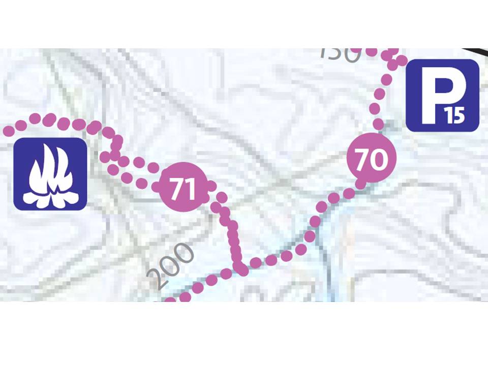
After 2 km you reach an intersection with Trail #71 headed in two different directions, one way leads to trail #72, the other way continues the trail #71 loop (a rather confusing set-up, see the map above).

In the picture below, I arrived from the left and continued to the right towards the rest area on trail #71 (as described in yesterday's post). From here it's another 2.5km to the rest area, then 1km to trail #70 and another 1km back to P15 (for a total of 6.5 km).

A round-trip to Brown cabin in one day would be doable but I wouldn't take this way Healey cabin unless I was staying there overnight. For a day-trip to Healey, trail #70 provides a much more direct route.


The second part of the trail leads to the very peaceful Carman lake. I was surprised to see open water on the lake near the trail.


When I saw the bridge I then realized that the lake empties out into a stream at this point.


Upstream view from the bridge looking back onto the lake.


Downstream from the bridge is an old water-level control dam.


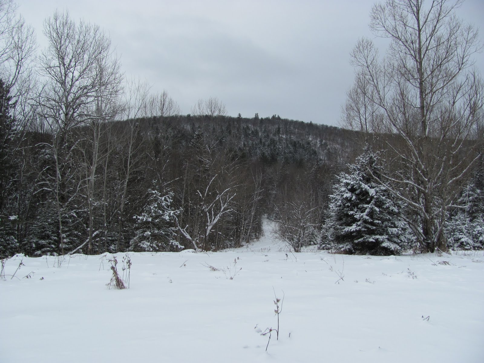
The third part of the trail takes us back into the mountains. You'll notice from the contour lines on the map above some rather lengthy and steep climbs. In the picture below, my camera is horizontal looking towards one of these steep sections.


After a while, the terrain levels out and the trail takes you through some very pleasant wooded areas of the park.


Thankfully a fire was already burning at the rest area, enough to keep warm during a quick snack before the last 2 km back to the parking lot.

Total time: 2h45m at a brisk pace and with short breaks.

Labels: , , ,

Saturday, January 15, 2011

Fluffy Conditions on Trail #71 in Gatineau

Directions: Highway 5 North until it joins Highway 105. Turn left at traffic signal and left again after 1.5 km onto Cross Loop Road. Parking lot #15 (P15) will be on your right after 2km.


From P15, a gradual 1km climb on Trail #70 awaits you before reaching Trail #71.


Trail #70 is fairly wide, looks like it serves as an access road during summer time. Today the snow was compacted on this trail from the numerous hikers and snowshoers. This section of trail #70 offers a very nice view of the adjoining valley.


After 1 km on trail #70, you reach an intersection with trail #71 on your right.


Trail #71 is more interesting as it cuts through some natural sections of the forest. Conditions were nice and fluffy with what looked like only a half-dozen snowshoe tracks before us.


After 1km along trail #71, you reach a rest area with a fire pit and two park benches.


There seemed to be a supply of wood under a plastic tarp, and I noticed a shovel and axe hanging on a tree nearby. We had to turn back at this point after a quick snack and didn't stick around very long.

I definitely want to go back to trail #71, it seems to compare well to trail #74 (see previous post), one of my favorite trails so far in the Gatineau Park.

Labels: , ,

Sunday, January 09, 2011

Trail #74 Gatineau Park

Following yesterday's outing on Wolf Trail, headed up to the Lac Philippe sector expecting to find more snow than the Meech Lake sector. As it turns out, that wasn't quite the case but conditions were nonetheless good.


Starting at parking lot 19 (P19), it's a bit more than 3km to reach the Renaud shelter. Once near the Renaud shelter, the Philippe and Pines shelters aren't far away and the Wanakiwin Yurt is just a bit farther.


The base was still thin along many sections of the trail, with branches and leaves piercing through the snow.


A warm fire was already burning in the stove at the Renaud shelter when I got there.


Here's a left and right view of the small Renaud lake.


Next to the lake is a group camp site (GR4) with a very nice "lean-to" style shelter.

Labels: ,

Wolf Trail

Also known as Blanchet Trail or Trail #62 in the Meech Lake sector of Gatineau Park north of Ottawa.

We finally received somewhere between 10 to 20 cm of fresh new snow, enough to tackle this classic trail in snowshoes. While ice and rocks could be found on various spots along the trail, the overall conditions were good.

Starting from parking lot #13 (P13), the trail splits after 500m. To the right is the rugged and steep section leading up to Mahingan lookout. To the left is the longer and easier section to the Tawadina lookout. The trail continues between the two lookouts to create a 7 km loop.


We find it better to climb the steep section to Mahingan and usually walk the loop in a counter-clock-wise manner.

Until you reach the beaver pond, streams often border the trail. Many of them were not frozen yet.


Streams could be crossed without too much risk.


The snow load on the branches was a welcomed sight.


A well-deserved rest for the legs after the 800ft vertical rise to the Mahingan lookout.


From here the view is quite pleasant.


After a snack to replenish our energy, we continued towards the spectacular Tawadina lookout.


Total time from start to finish: about 3h15m at a reasonable pace with a 10 minute break along the way.

Labels: , , , ,